Marea y Clima · Android 1.1
User manual
A practical guide to checking weather, wind, sea conditions, tides, the Sun, the Moon and maps, and to configuring app alerts.
Purpose and getting started
Marea y Clima brings together weather, marine and astronomical information for towns and beaches. This manual follows the app’s actual order: initial setup, main controls and the six sections in the bottom bar.
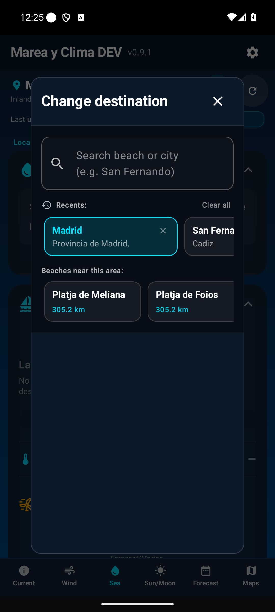
Choose a destination
Tap the town name or the arrow in the header to open search. You can select a town or beach manually without using GPS.
Initial permissions
Location
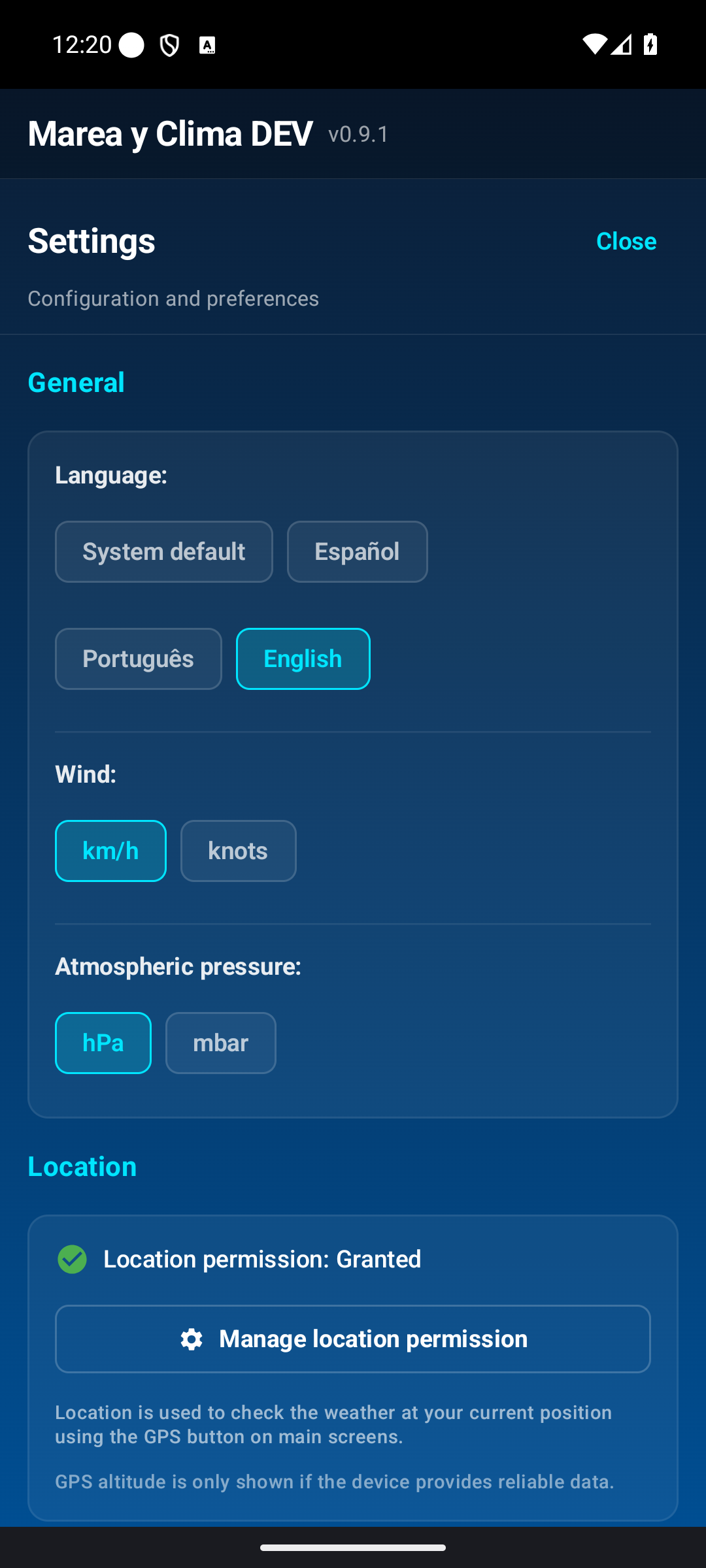
Location is optional and enables My location. If Android offers precise location, enabling it helps distinguish nearby towns, beaches and ports and improves the chance of a reliable GPS altitude when the phone provides one.
- Open Settings using the cog.
- Find the Location section.
- Tap Manage location permission.
- Grant permission and, if shown, enable Precise location.
The app works without GPS. Altitude may still appear as Not available if the device does not provide a reliable value.
Notifications
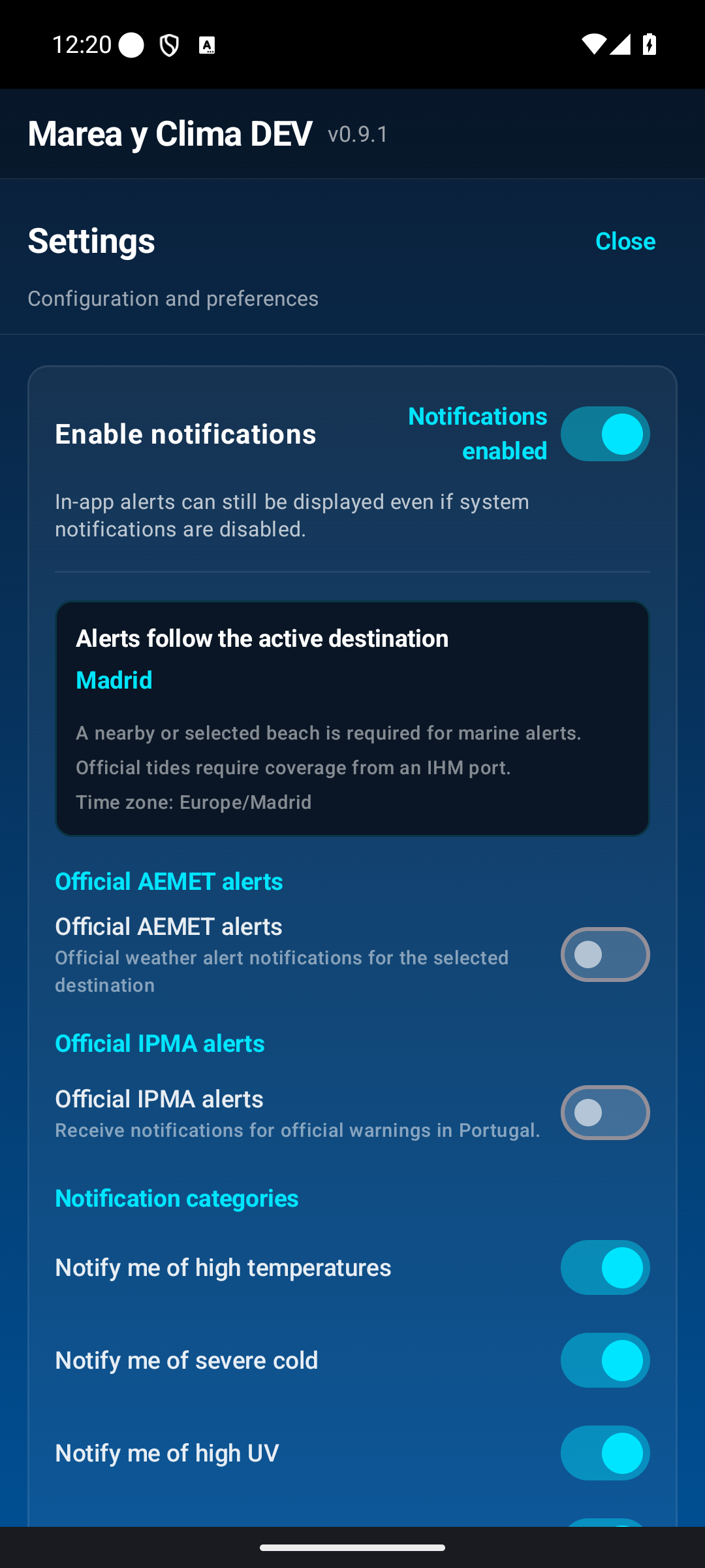
If you want alerts, first enable Settings → Notifications and alerts → Enable notifications and grant Android permission when prompted.
Current · Air and allergies
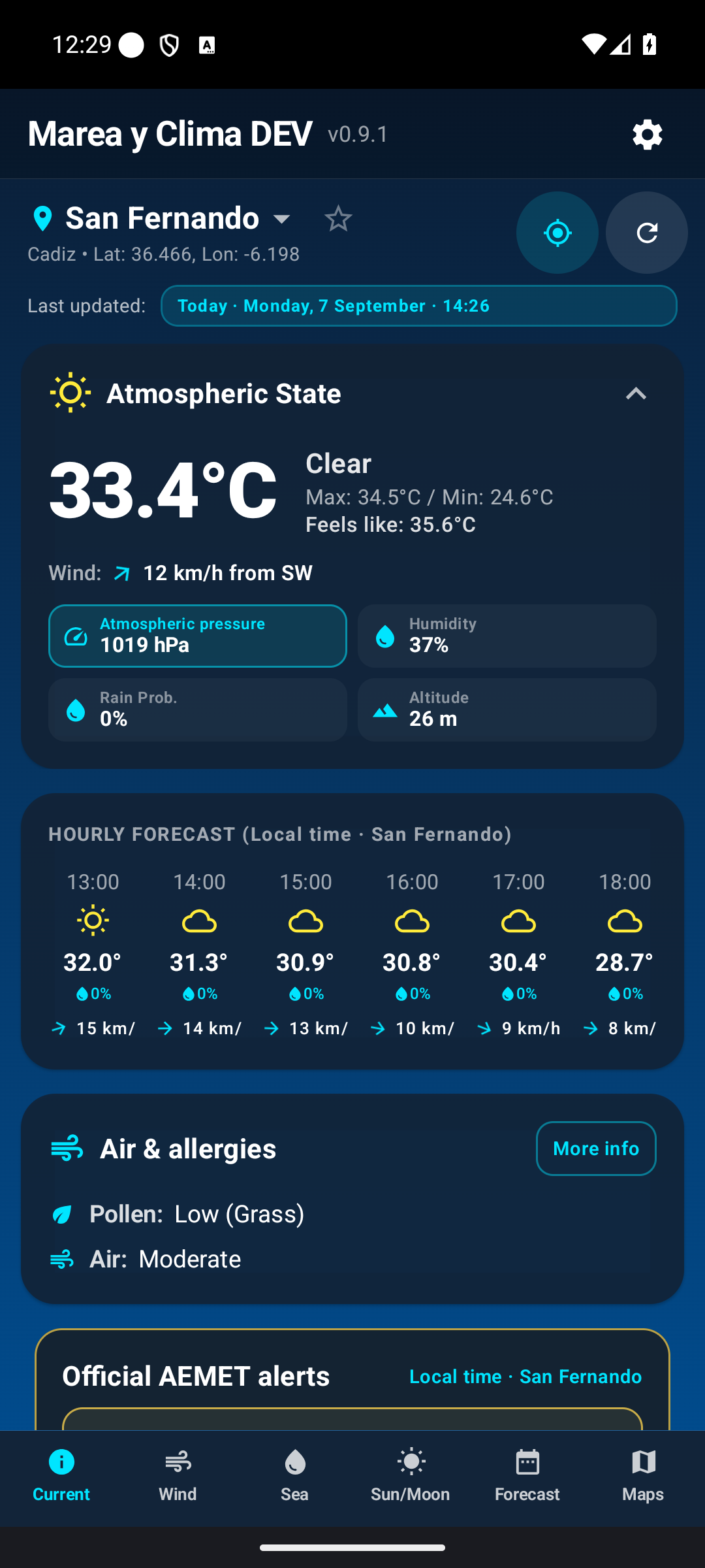
This screen answers two questions: what is the weather like now, and what is expected over the next few hours? It shows current, maximum and minimum temperature, feels-like temperature, sky conditions, wind, pressure, humidity, rain, GPS altitude when reliable, the next-hours forecast, air and allergy information, and alerts when available.
Next few hours
Swipe within the card to see hours that do not fit on screen.
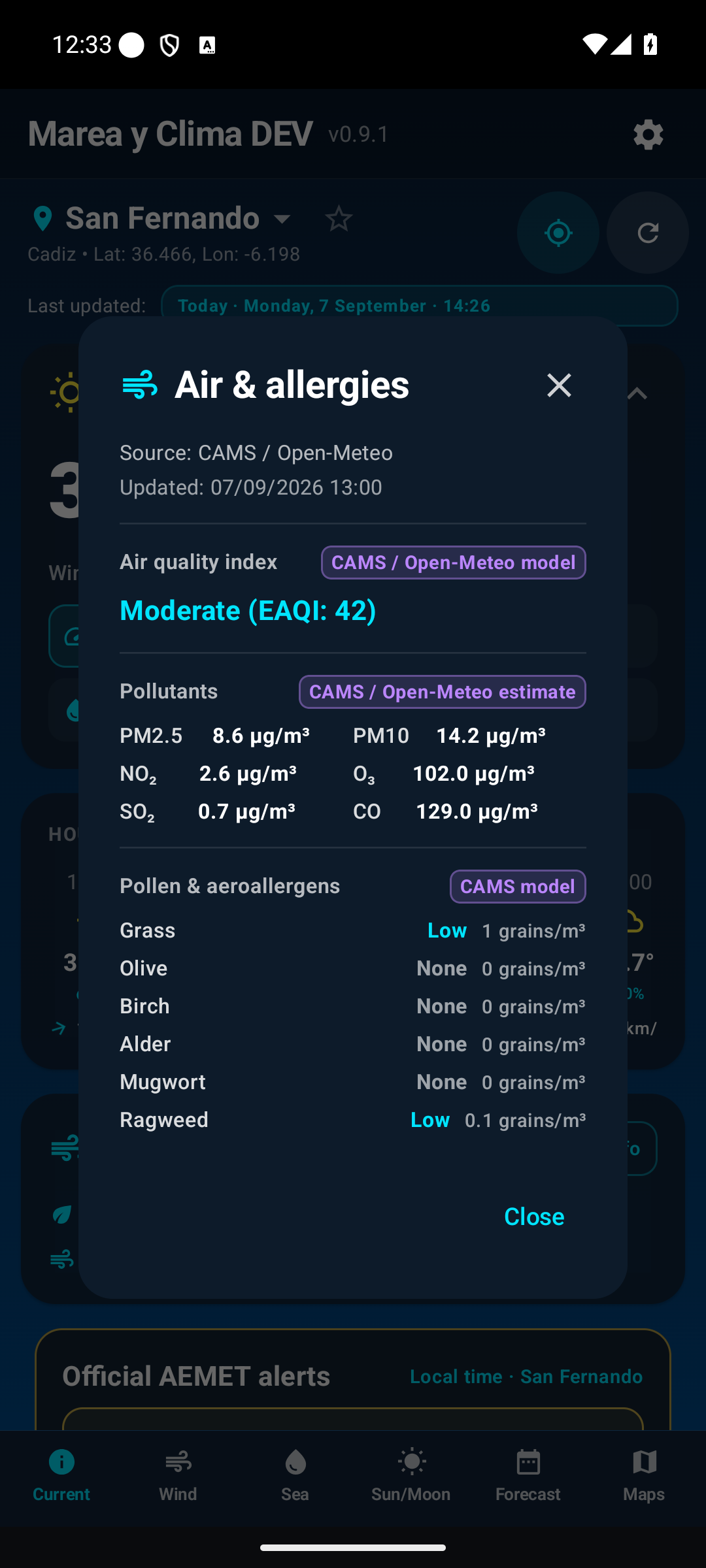
Air and allergies
The card summarises air quality and pollen. Tap More info to see pollutants, pollen and the source of each value. Official data and an atmospheric estimate can appear together; the app labels them so they are not confused.
Wind
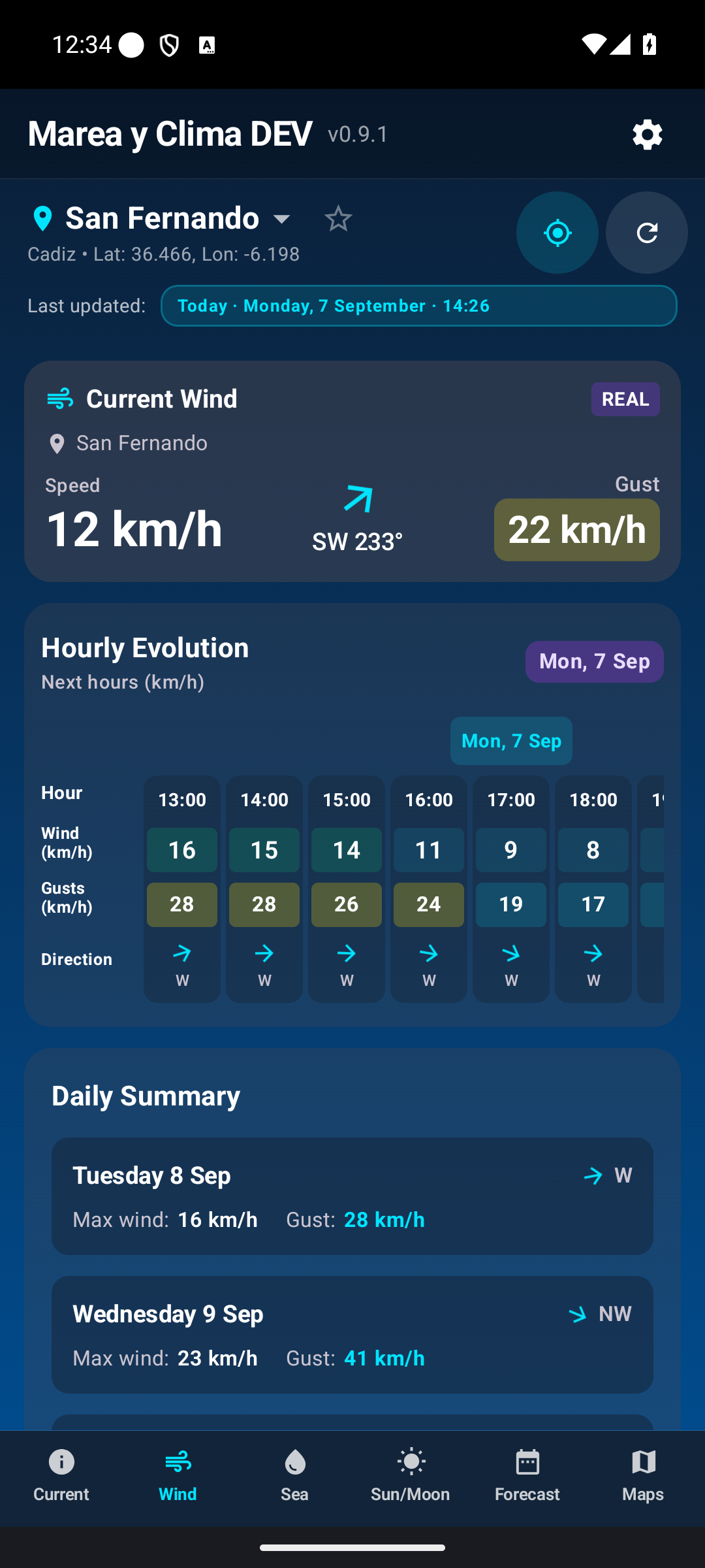
This screen provides more detail than the wind block on Current.
- Speed: sustained wind.
- Gust: strongest peak.
- Direction: where the wind comes from; “from SW” means it arrives from the south-west.
- Hourly trend: how it changes through the day.
A summary for the coming days appears further down.
Sea · Tides, swell, water and bathing
Tides
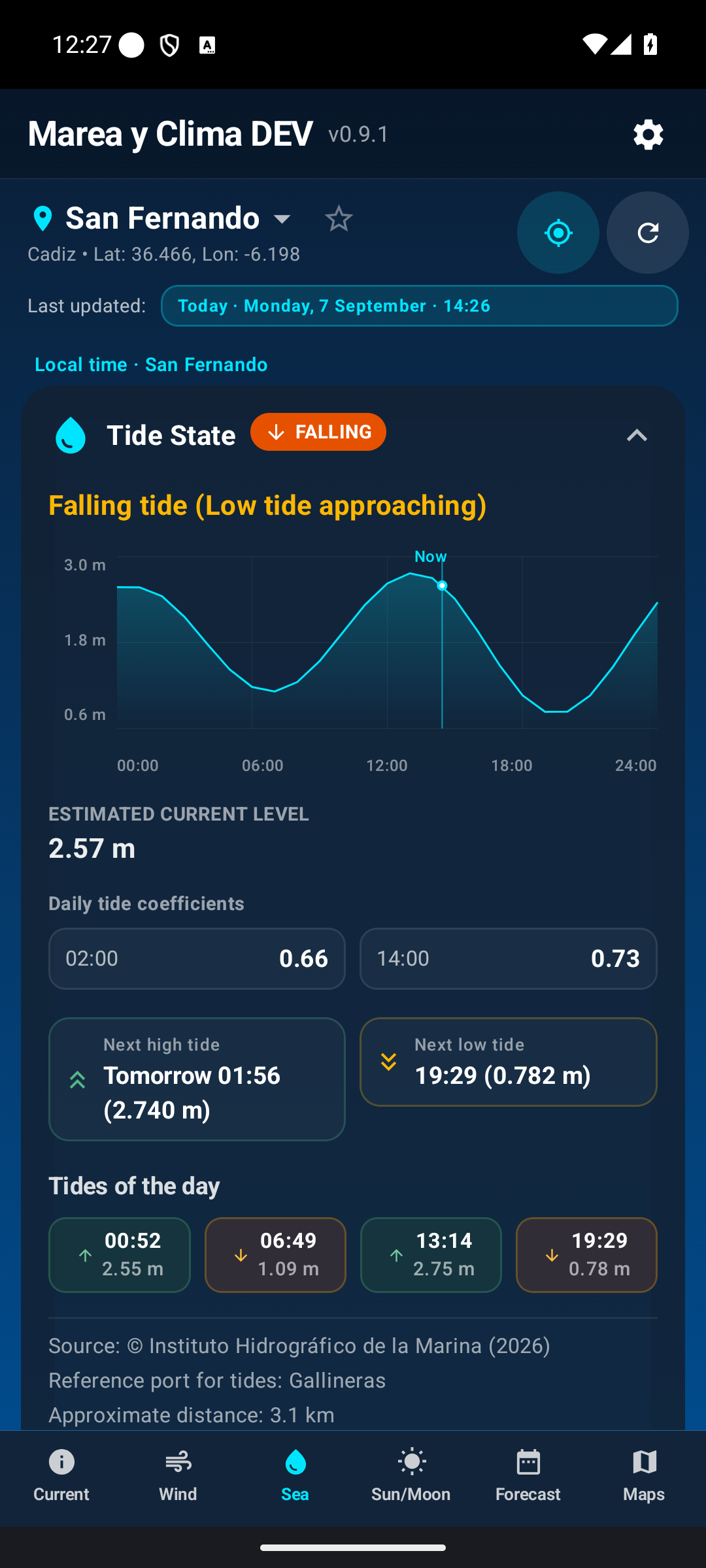
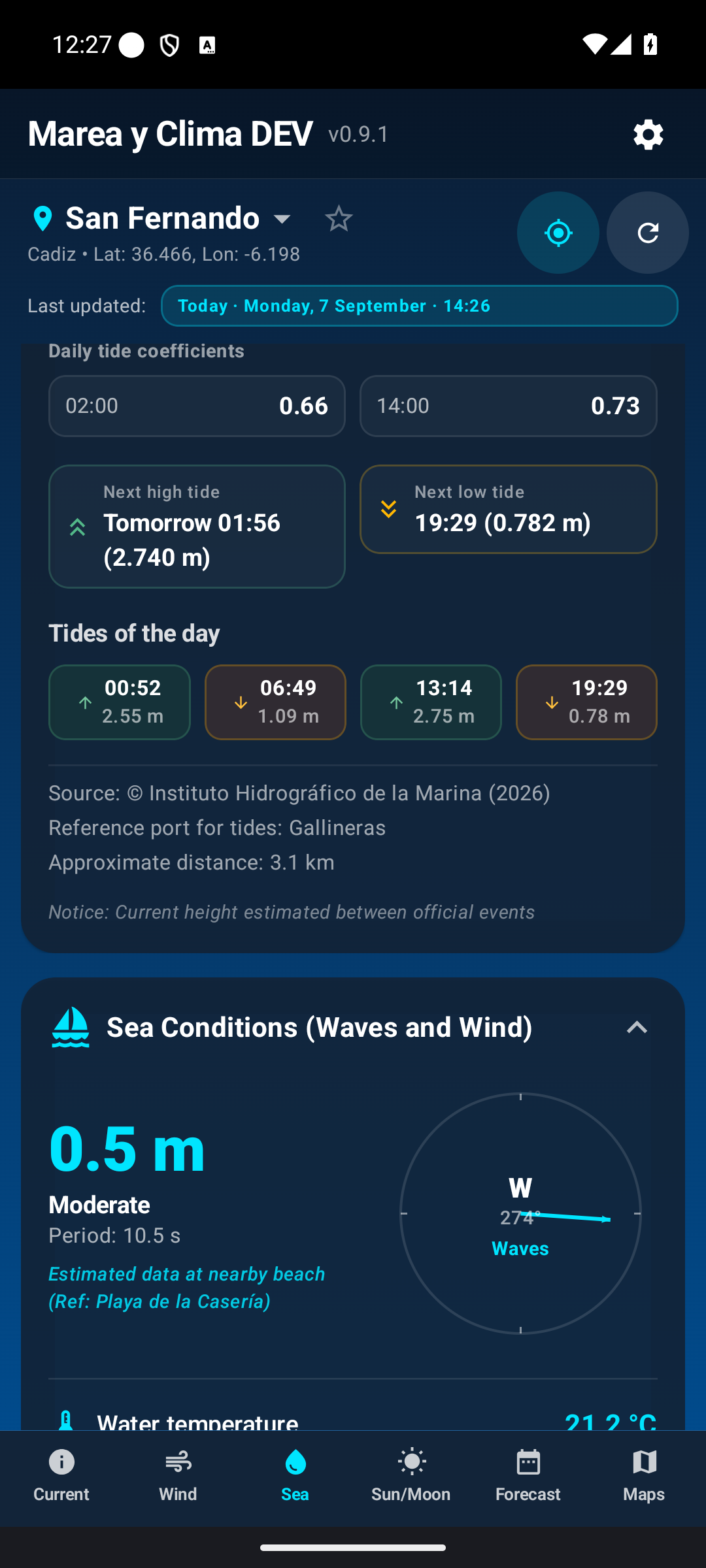
At coastal locations the screen shows the tide state, next high or low tide, an estimated height and a chart. Rising means the level is moving towards high tide; Falling means it is moving towards low tide. Current height is calculated between official events and is not an instantaneous sensor reading. The reference port identifies the official source used.
Swell and water temperature
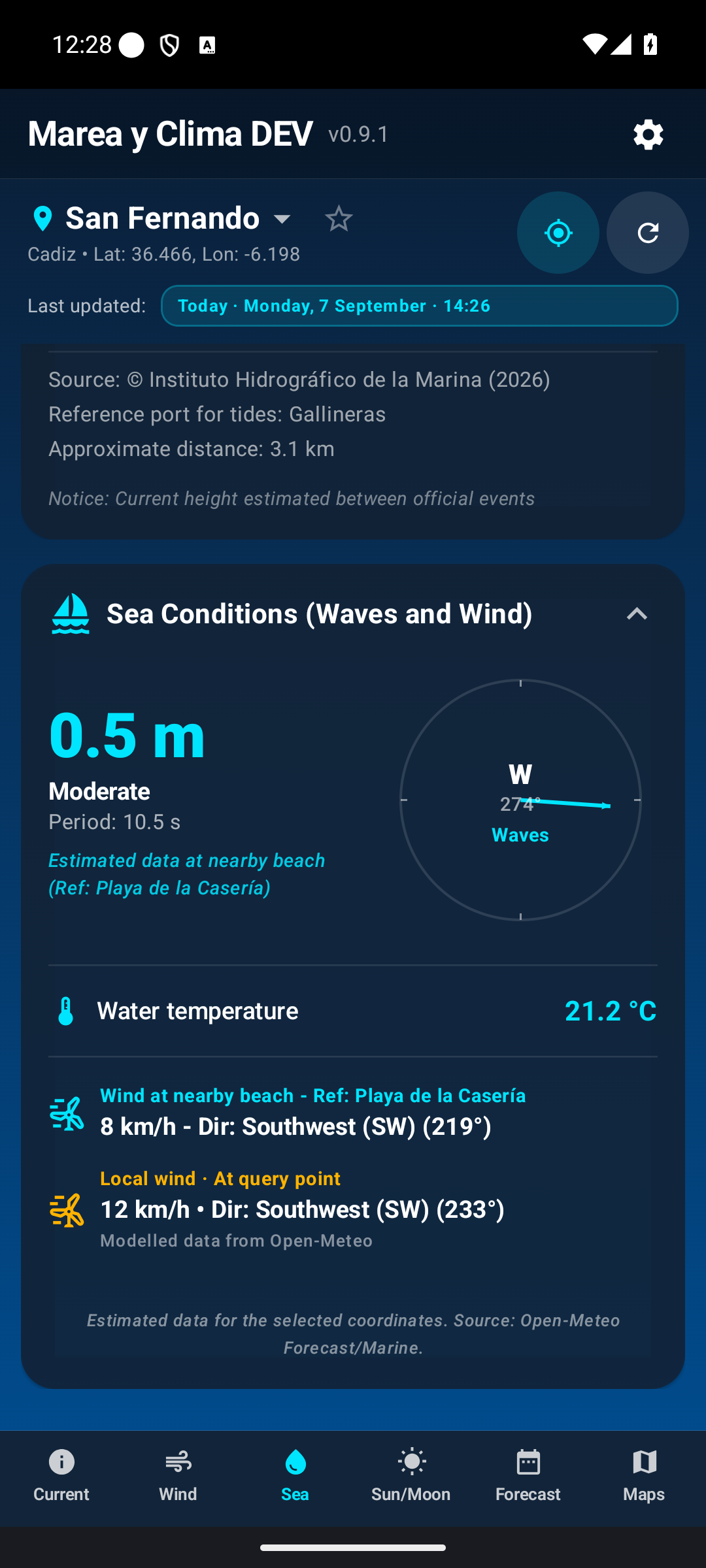
- Wave height: significant wave height.
- Period: time between wave crests.
- Direction: swell orientation.
- Water temperature: shown when the source has coverage.
Bathing assessment
An advisory summary of favourable conditions, caution or not recommended.
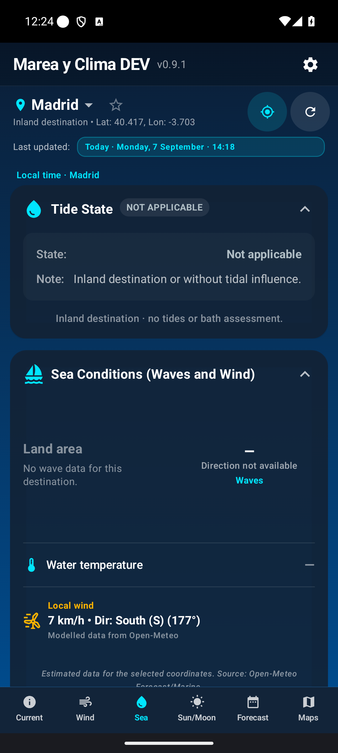
Inland destinations
Tides and swell appear as not applicable or not available because marine data is not meaningful for that destination.
Sun and Moon
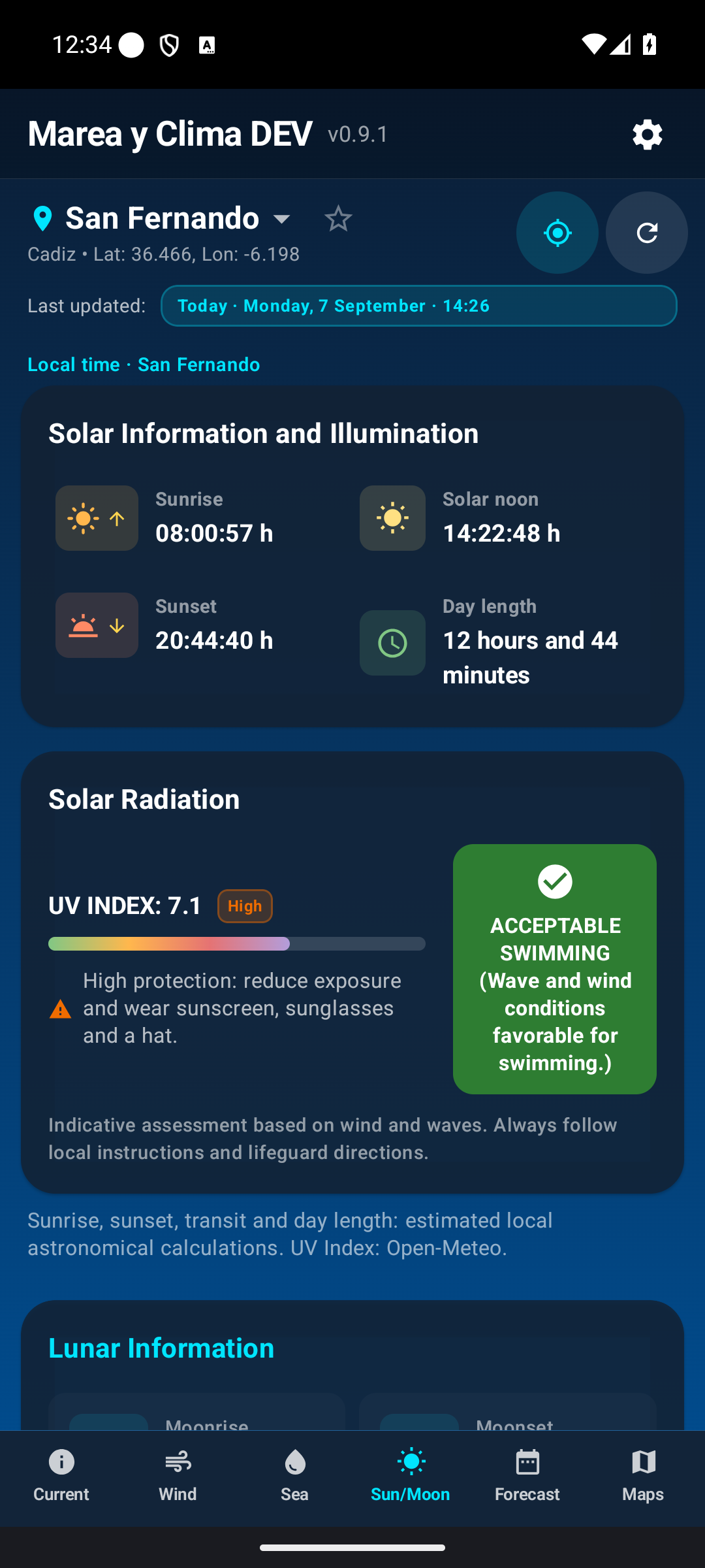
The solar section shows sunrise, solar noon, sunset, day length and UV index. Low, Moderate, High, Very high and Extreme UV levels include recommendations.
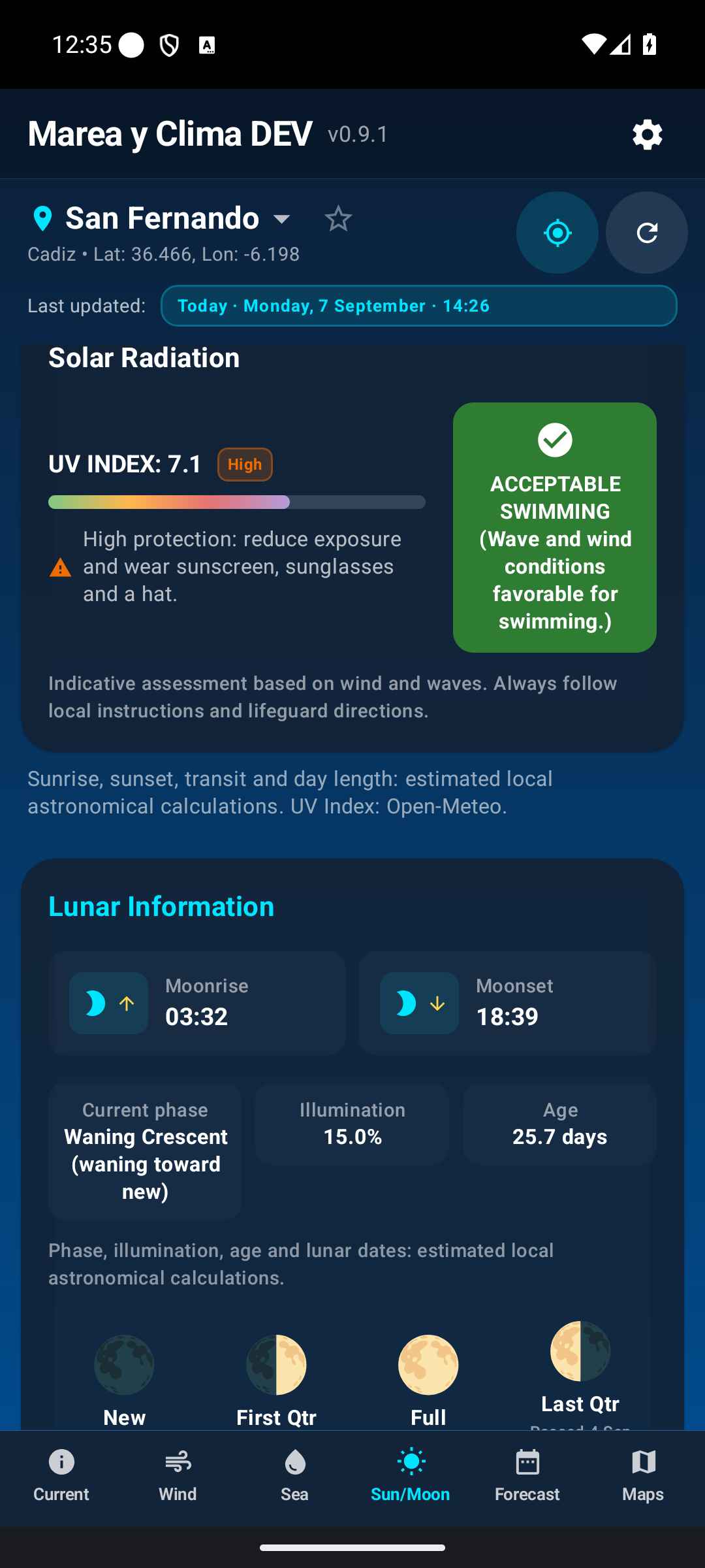
The lunar section shows moonrise and moonset, phase, illumination and lunar age. The phase summarises the current point in the cycle.
Forecast
The top carousel lets you choose a day. If the date is not visible, swipe the carousel, tap the day and review the hourly trend. Then scroll down to the selected-day summary.
The summary brings together weather, Sun and Moon, UV, air and pollen, and, where relevant, bathing conditions, swell and the coastal reference. Sources have different forecast horizons: a value may be available for tomorrow but not for a later date. The app shows Not available instead of filling gaps with invented values.
Maps
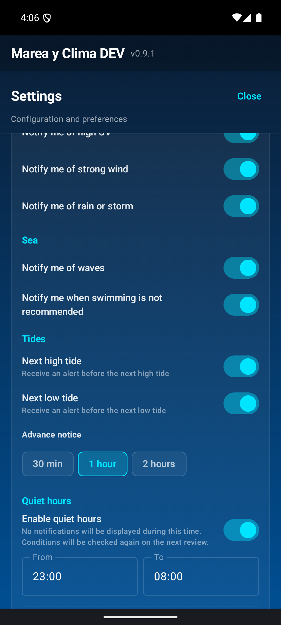
Choose the product that matches what you want to inspect.
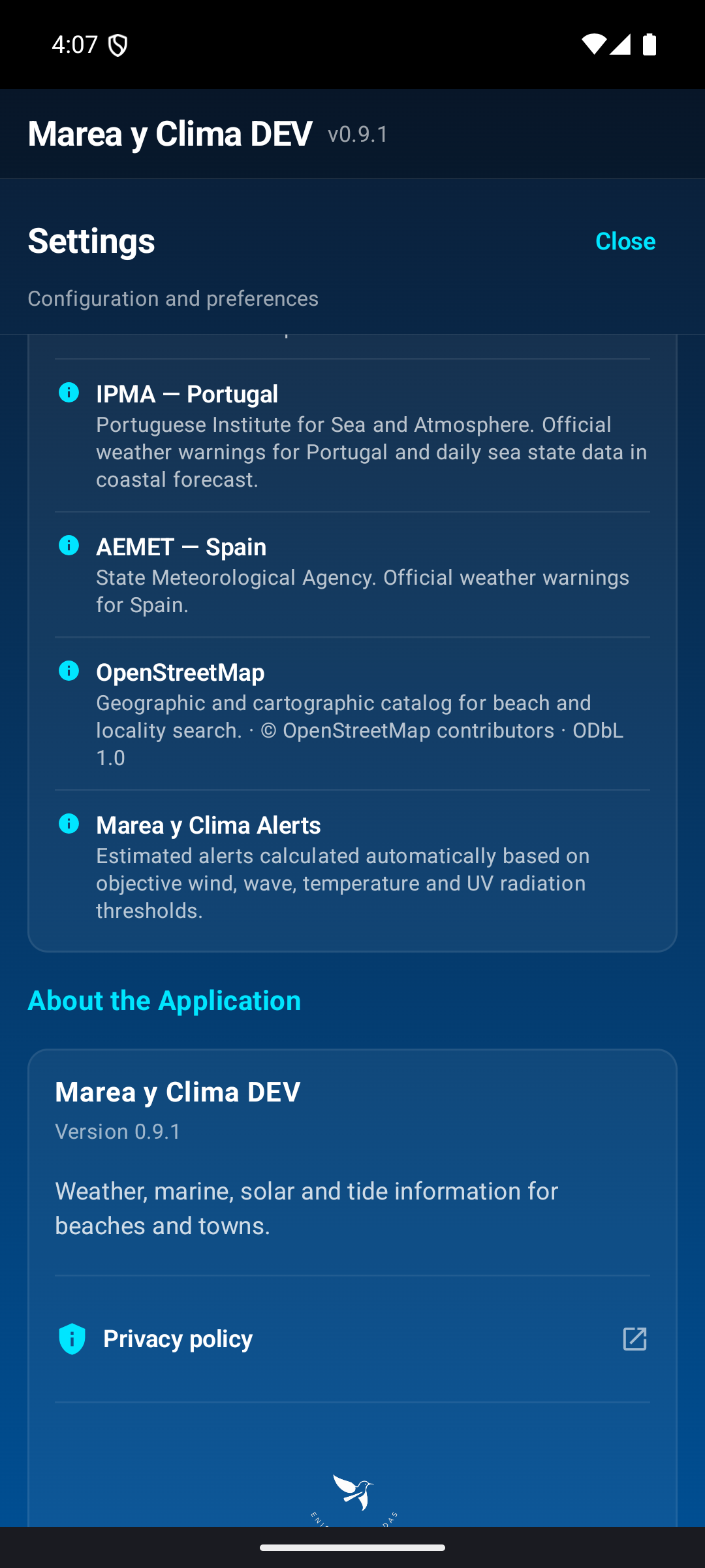
Where precipitation is detected. Choose an area or radar, move the map, and use the timeline and Play/Pause when available.
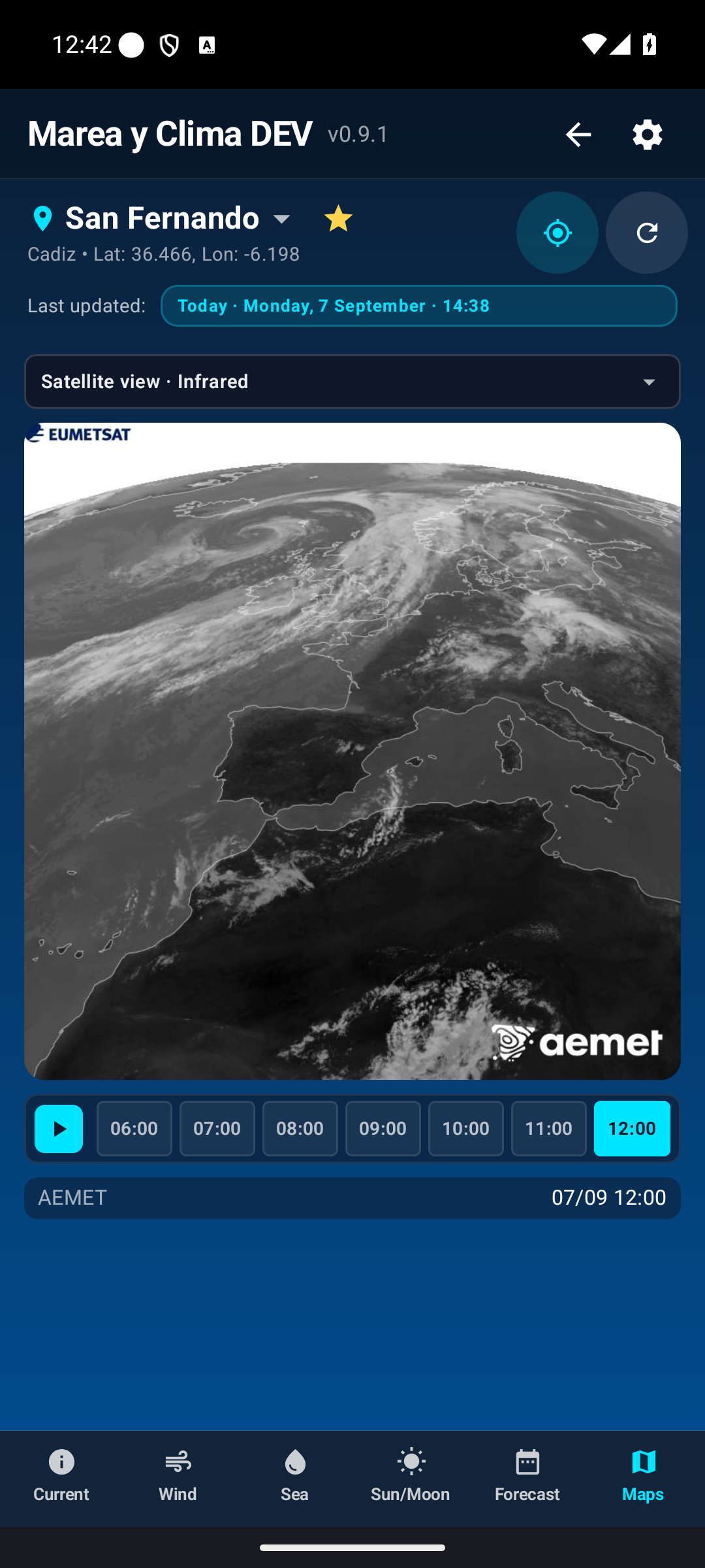
Cloud cover and satellite products. The Visible channel needs daylight; use Infrared at night.
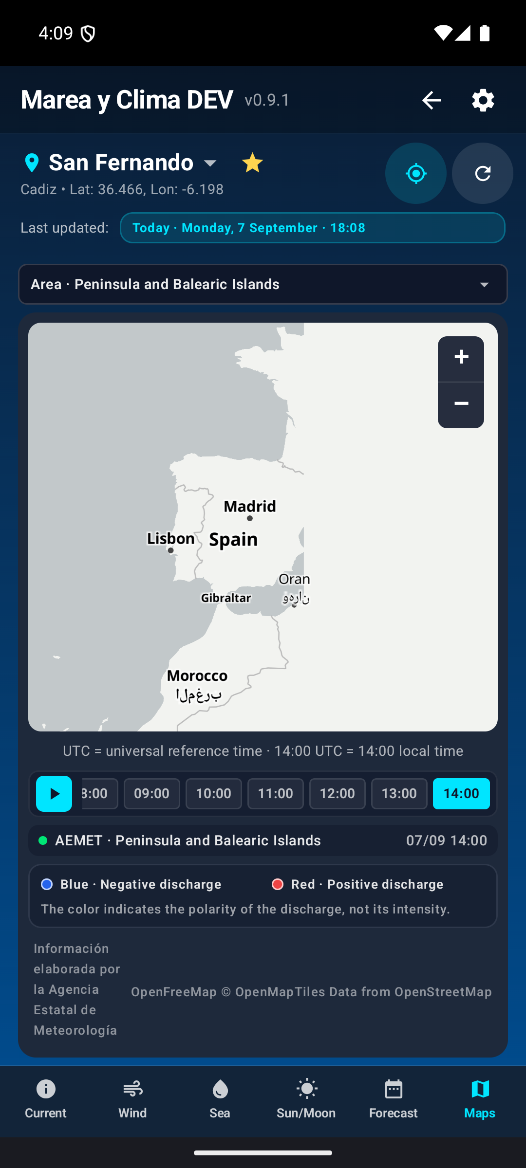
Recent electrical activity. Colours may distinguish polarity.
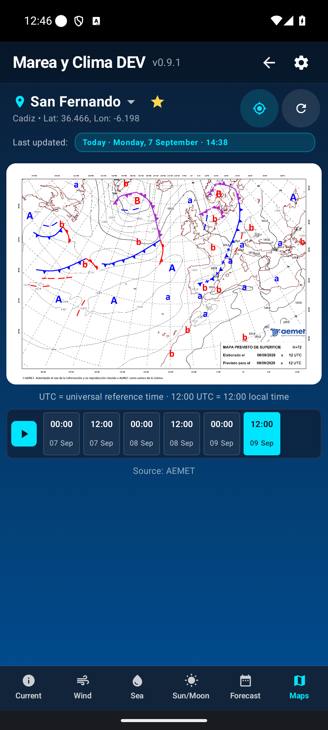
Pressure, fronts, high- and low-pressure systems, and atmospheric circulation.
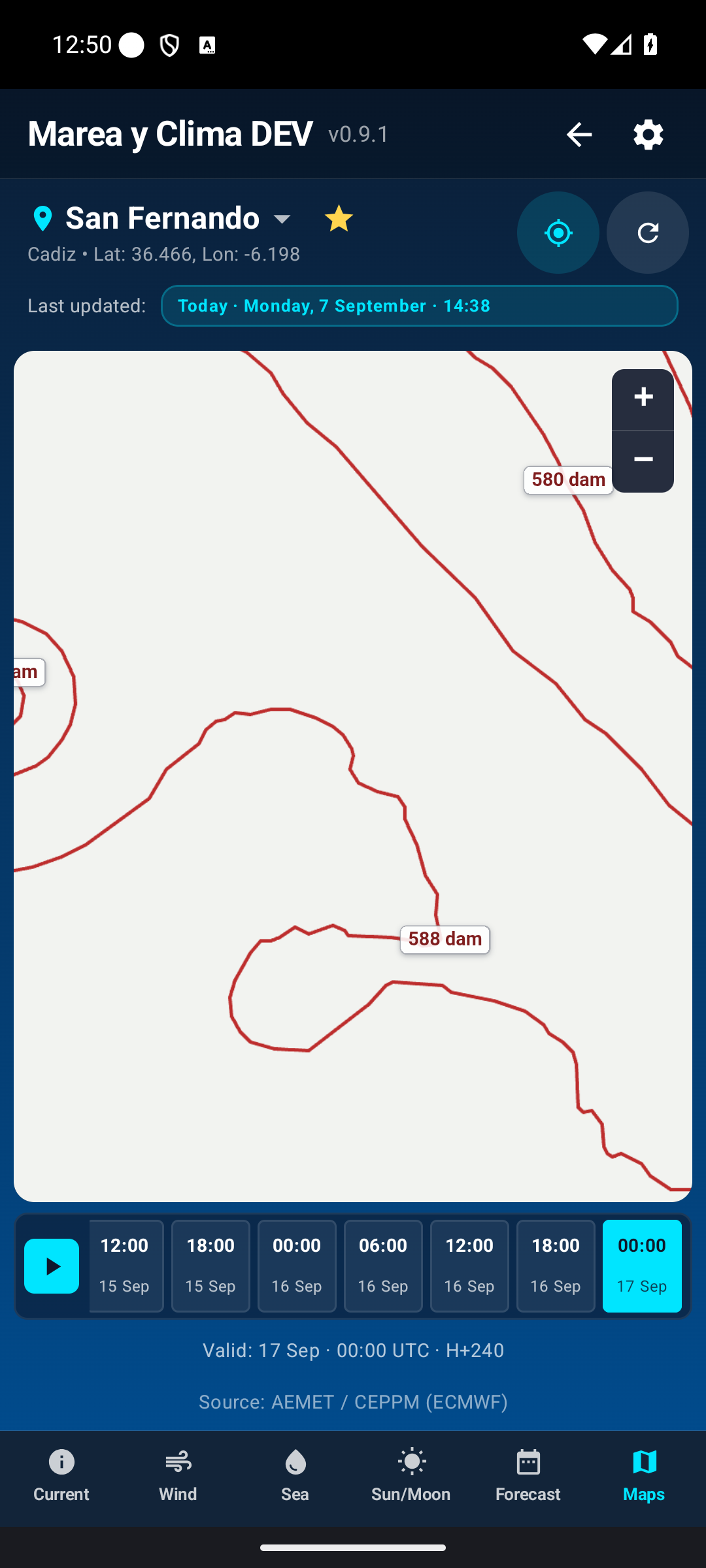
Atmospheric circulation aloft; this is a more technical view.
To return, use the top back arrow, tap Maps again in the bottom bar, or use Android Back.
Settings
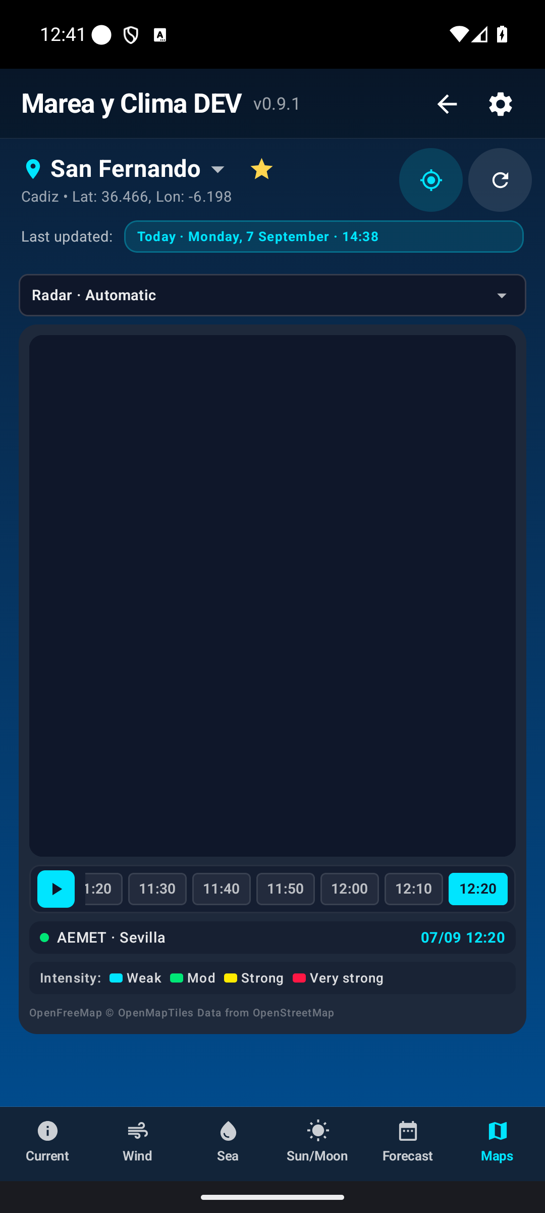
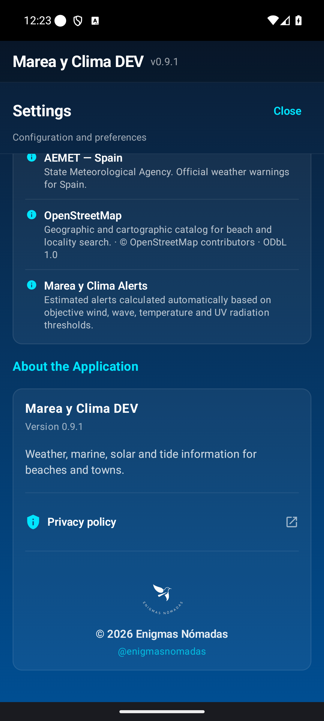
The cog opens language, units, location permissions, notifications, data and sources, and About.
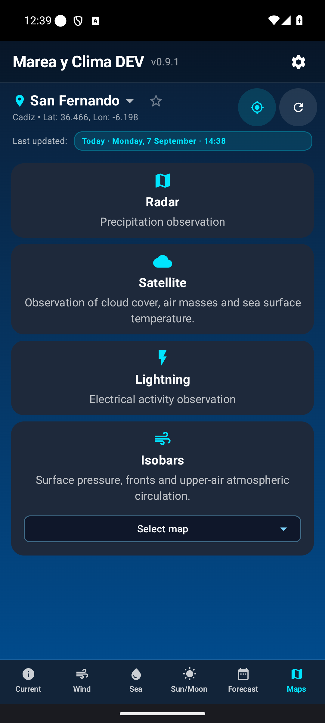
Notifications and categories
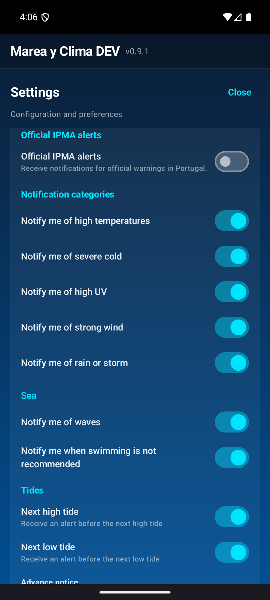
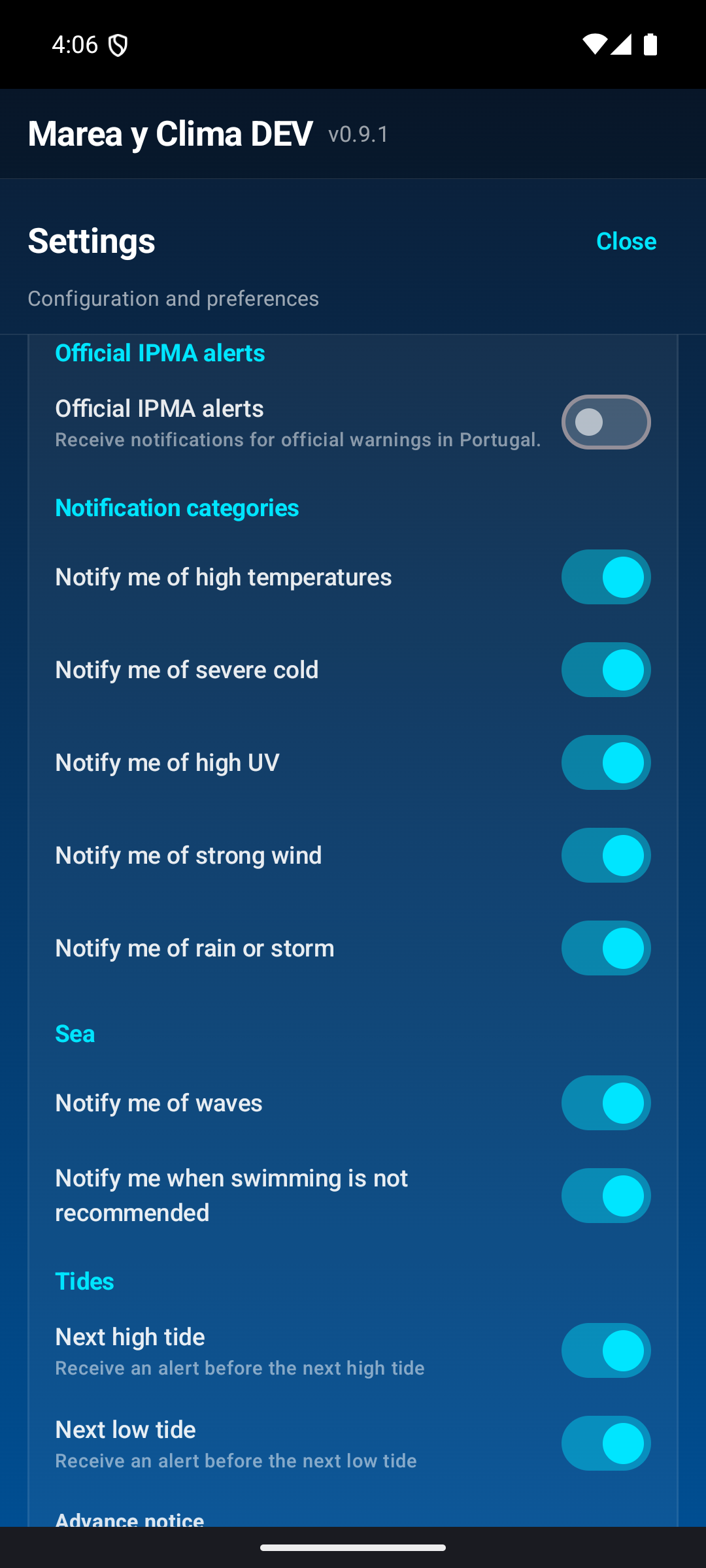
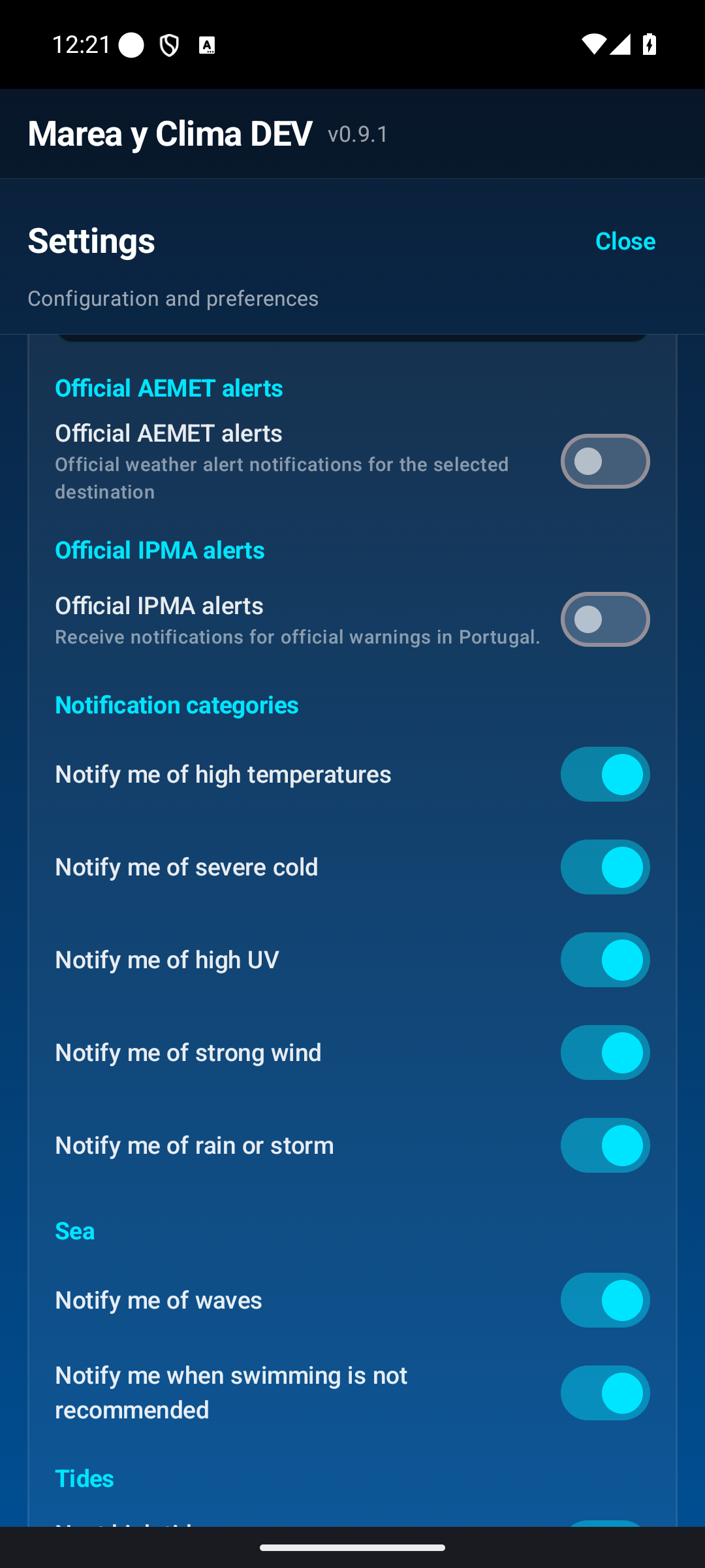
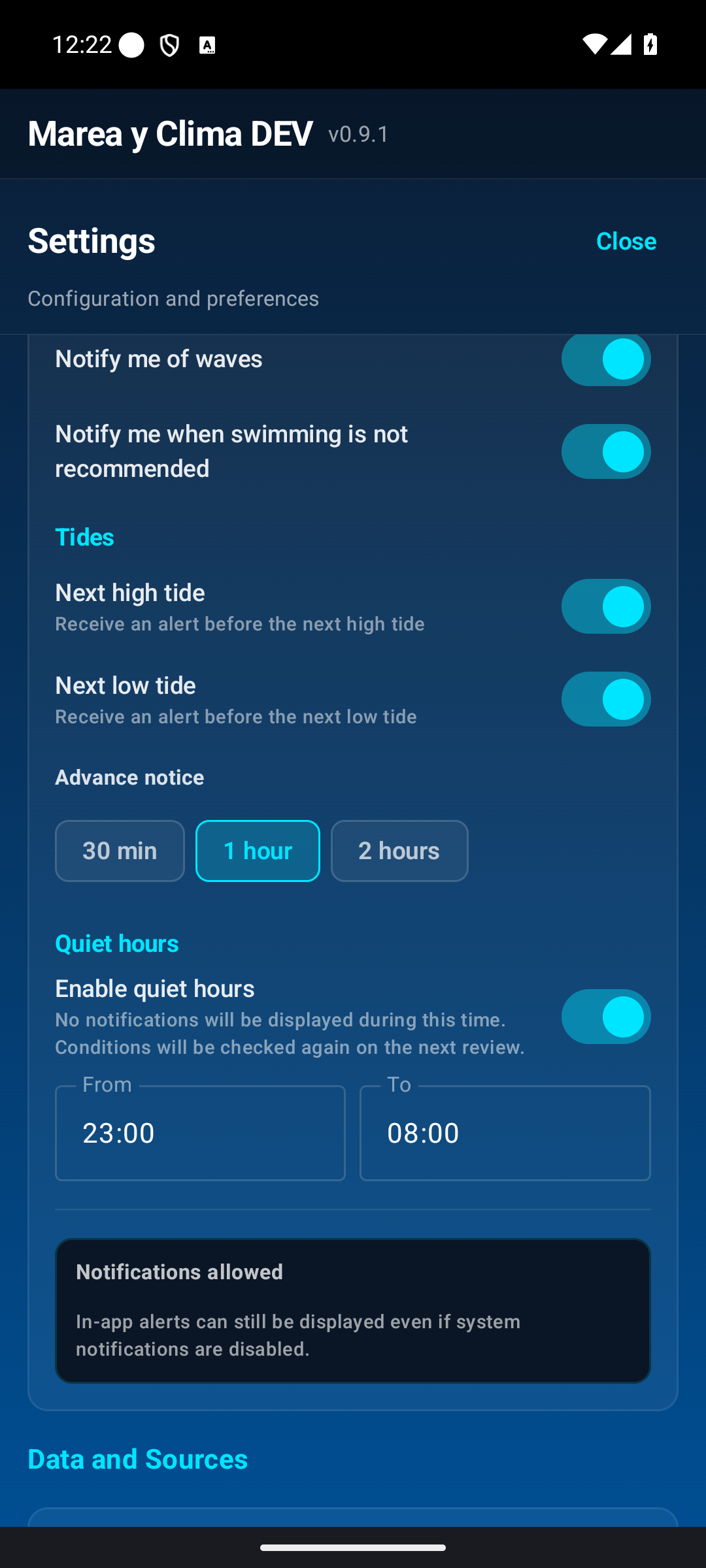
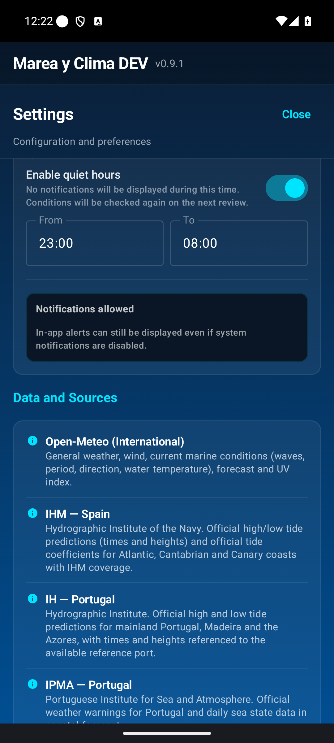
The main switch enables alerts. You can then choose official AEMET/IPMA alerts and categories such as heat, cold, UV, wind, rain/storms and sea separately. High- and low-tide alerts have their own settings and advance notice.
Quiet hours
Prevents disturbance during your chosen period. Before closing the app, check the destination for which alerts are calculated.
Home screen widgets
Marea y Clima includes Android home screen widgets that allow you to check weather and coastal conditions without opening the app.
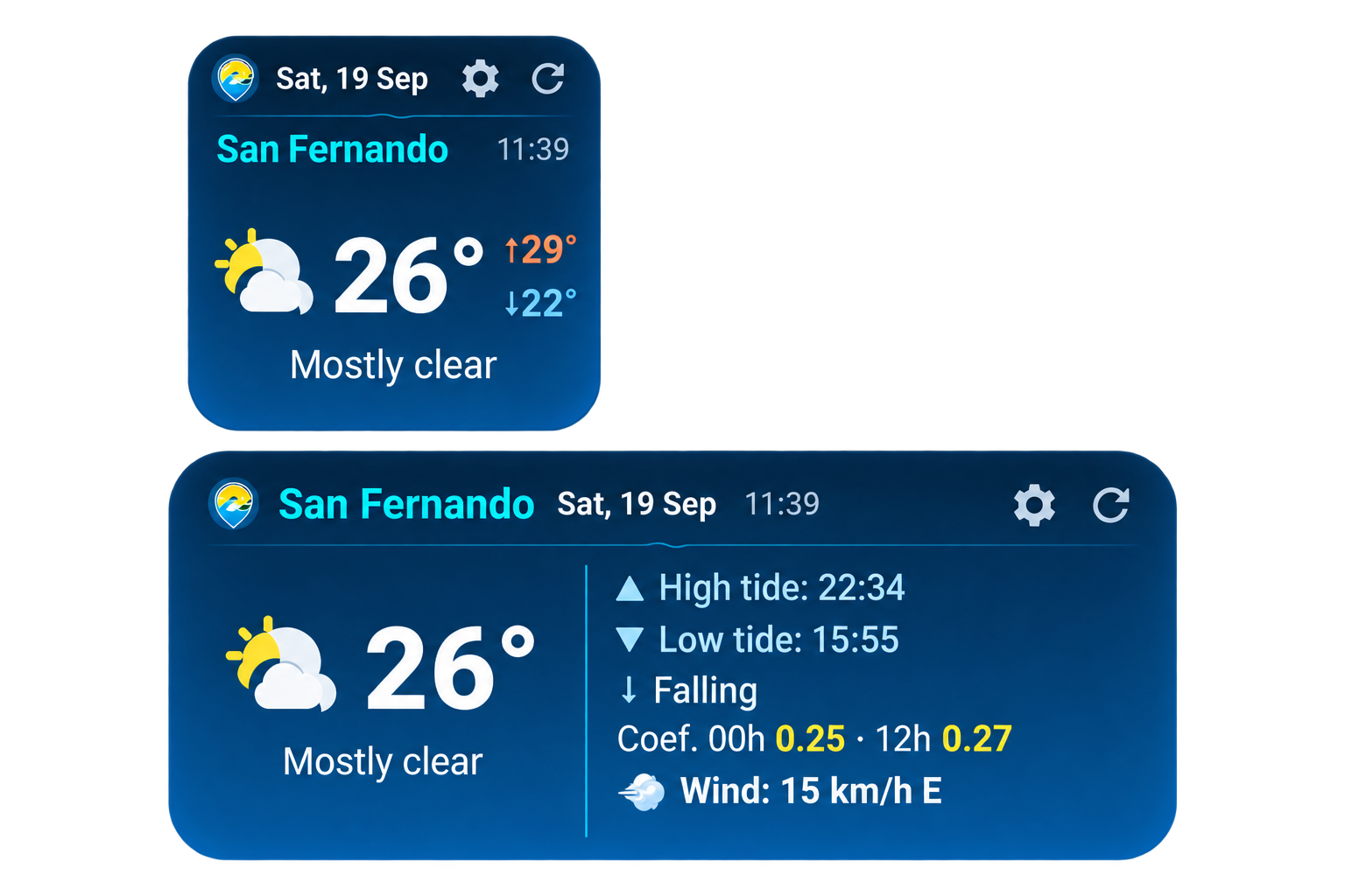
Two available widgets
- Weather (2x2): Shows the current phone time, destination, sky conditions with weather icon, current temperature, and daily maximum (↑) and minimum (↓) temperatures.
- Sea and beach (4x2): A panoramic format designed for coastal destinations. The left section presents the current temperature, weather icon, and sky description. The right section gathers essential marine data: times for the next high tide (▲) and low tide (▼), water level trend (↑ Rising or ↓ Falling), official daily tide coefficients (00h and 12h) or amplitude, and sustained wind speed with direction.
How to add a widget
- Touch and hold an empty space on your Android home screen.
- Select Widgets from the menu that appears.
- Find Marea y Clima in the list of applications.
- Choose Weather (2x2) or Sea and beach (4x2) and add it to your home screen (drag it or tap it depending on your launcher).
- On the configuration screen that opens automatically, select My location or Fixed location, choose the appearance (Normal or Transparent), and tap Save to confirm.
Steps may vary slightly depending on the phone manufacturer and Android version.
Inland destinations and coastal areas without tide data
If you place the 4x2 widget for an inland destination or a coastal area without an associated official tide station, the marine area clearly displays No tides (inland area) or No tide data while keeping wind and weather conditions visible.
Individual configuration and settings
Tapping the settings cog (⚙) on any widget opens its dedicated configuration screen with a real-time preview, organized into two tabs:
- Location: Choose between My location (uses the device’s GPS or last known position, requesting location permission) or Fixed location (includes an interactive search tool to find and pin any specific beach or town permanently).
- Appearance: Switch between Normal (standard solid dark marine card) and Transparent (translucent background with high contrast designed to blend over any launcher wallpaper).
Multiple instances
You can add as many widgets as you need to your home screen, combining 2x2 and 4x2 sizes. Each instance operates with an independent identifier, allowing you to have one widget set to “My location” and others fixed to favorite beaches or cities, each with its own appearance style.
Updating and controls
- Automatic updates: Android manages background updates via WorkManager with an approximate cadence of ~60 minutes, evaluated opportunistically and subject to system battery-saving and Doze policies. Minute-exact hourly synchronization is not guaranteed.
- Header time: The time displayed in the top header is the phone’s current clock time (formatted in the destination’s timezone), not the forecast issue timestamp.
- Manual refresh: Tap the circular refresh arrow (↻) in the widget header to trigger an immediate network refresh. A spinner appears while data is loading.
- Quick app access: Tapping the widget body or app icon opens Marea y Clima directly.
Data sources
Spain’s official meteorological agency.
Portugal’s official weather and sea institute.
Instituto Hidrográfico de la Marina; official Spanish tides within its coverage.
Official tide source for mainland Portugal, Madeira and the Azores.
Official air-quality sources for Spain and Portugal.
European atmospheric information and forecasts.
Weather and marine forecasts.
Mapping and geographical support.
Meaning of data states
Published by a public body or official source.
Successfully retrieved for the current request; not necessarily an instantaneous sensor reading.
A result calculated by forecasting systems.
The last stored value when a newer one cannot be obtained.
No reliable value exists for that place or time; it does not mean zero.
The data is not meaningful for that destination.
The source does not cover that area or product.
Frequently asked questions
Check the main switch, Android permission, categories, active destination and quiet hours.
No. You can search for towns and beaches manually.
Use the circular arrow or pull down.
You are probably over a carousel; use the bottom bar.
Because tides and swell do not apply there.
Sources have different forecast horizons.
Final quick guide
Town name or arrow.
Blue target.
Star.
Circular arrow or pull down.
Settings → Notifications and alerts.
Maps → Radar or Satellite.
Sea.
Forecast → choose day → scroll to summary.